
Insurance
Are private insurers ready to take on the U.S. flood problem?

The U.S. flood problem
Floods account for eight of the ten most damaging natural disasters in the U.S. and have by far the most impact on people’s homes and lives. Only about 12% of U.S. homeowners purchase flood insurance, and most obtain it through the National Flood Insurance Program (NFIP). The resulting gap in protection could be as much as a $40 billion opportunity for private insurers. With the NFIP struggling with insolvency for decades, clearly, there’s a need for private insurers to play a larger role in the flood market. Technology, in the form of advanced catastrophe modeling, could clear the way to make that happen.
How the private market is developing
Enacted by Congress in 1968, the NFIP was the government’s response to the lack of availability of private insurance and the rising cost of disaster assistance due to floods. Floods were considered an “uninsurable risk” at the time, so the Federal Emergency Management Administration (FEMA) took over the management of NFIP and built into it three components: providing flood insurance, improving floodplain management, and developing maps of flood hazard zones, known as Flood Insurance Rate Map (FIRM). NFIP policies can be purchased directly from FEMA or through FEMA-authorized private carriers known as “Write-Your-Own” (WYO) insurance carriers. WYO companies act as intermediaries, with FEMA setting terms, rates, and premiums and the WYOs issuing policies and handling claims. Over the years, additional legislation refined the NFIP and attempted to make it more fiscally sound through reforms meant to transfer more risk to the private sector while the government focuses on mitigation. Both the Biggert-Waters Flood Insurance Reform Act (2012) and Homeowner Flood Insurance Affordability Act (2014) encouraged greater involvement of the private market. Opening the door to private insurers was a first step, but some barriers still exist. For example, private carriers cannot compete with WYO carriers; they have no access to NFIP policy and claim data; and there remains a great deal of regulatory uncertainty at the state level. But one of the most significant challenges is insurers' awareness that using traditional approaches and NFIP flood maps to predict and manage flood risk won’t allow them to participate in the market profitably.
Flood maps: Their history and shortcomings
For the past 40 years, FEMA’s primary tool for managing and pricing flood risk are the maps they develop. Private carriers see serious problems in using these maps to calculate the exposure and the aggregation risk, such as:
- The maps are woefully outdated—some haven’t been updated in over a decade.
- Frequent flooding exists outside designated flood zones, indicating underlying trends such as rapid urbanization are changing the risk.
- They rely on historical statistical techniques that don’t include a risk accumulation metric. The nature of flood risk itself makes it difficult to capture accurately on a flood map. Unlike hurricanes or earthquakes, floods are so localized that one house can be underwater while the one next door remains untouched. Factors like soil type, topography, and land use have a huge impact and further hamper the precision of using flood maps to model the risk.
Problems exposed by Hurricane Harvey
Hurricane Harvey, the Category 4 hurricane that hit the south-central coast of Texas in 2017, was a lesson in the limitations of flood mapping. It also exposed the serious NFIP underpricing problems in flood-prone areas. Even before Harvey the NFIP had incurred a cumulative debt to the U.S. treasury of more than $26 billion.
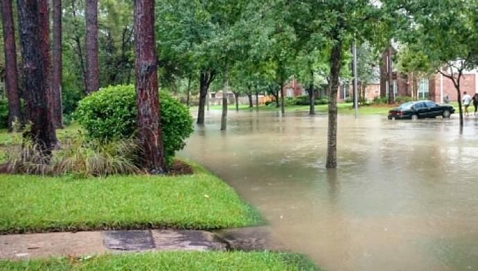
After stalling for several days on the Gulf Coast and slowly moving inland, Harvey left in its wake unprecedented flooding in Houston and thousands of square miles beyond. Seventy-five percent of the claims from Harvey were outside Special Flood Hazard Area (SFHA), which are high-risk areas defined by FIRMs as land that would be inundated by a flood having a one-percent chance of occurring in any given year. The precipitation it generated was what meteorologists say was close to the “thermodynamic maximum possible level” and shattered assumptions built into the models. Experts predict that tropical cyclones are likely to increase, and Harvey demonstrated why these storms are now the primary cause of inland flooding. The catastrophe models used to study Hurricane Harvey clearly showed eye-opening comparisons between the relatively well-contained coastal surge footprint and the expansive inland flooding footprint. The difference was staggering.
Better tools bolster insurer confidence
Since Harvey, underwriters have developed a better understanding of the physics of flooding, and new, more powerful tools provide a more realistic view of the risk. Innovative models are changing our understanding of how water flows over floodplains. For example, when water flows over a levee or riverbank, it fans out in multiple directions, making those floodwaters largely unpredictable using traditional models. More advanced modeling techniques make it possible to develop more realistic predictions for these scenarios. High resolution typography satellite data and land use information give a more accurate picture of where and how flooding can occur. New catastrophe modeling tools can help insurance companies underwrite, price, and manage flood portfolios. They combine climate and weather models and include advanced modeling of tropical cyclone precipitation. New modeling technology holds many advantages over FIRM maps in that the new technology:
- Better reflects current conditions
- Allows underwriters to quantify a risk by industry, region, or individual property
- Provides loss estimates in real time
- Allows underwriters to run scenarios to estimate future events and losses
The fact that all 50 states have experienced floods in the past five years—with so few homeowners covered by insurance—creates an urgent situation. But will homeowners purchase it willingly? The answer to this question and exactly what private participation in the flood insurance market will look like remain to be seen. However, it’s apparent that the current system isn’t working. Technology in the hands of underwriters who understand flood risk and can work effectively with government and the public to help mitigate the risk seems to be the most promising solution.


©2026 Applied Underwriters, Inc. Rated 'A-' (Excellent) by AM Best. Insurance plans protected U.S. Patent No. 7,908,157.
We use cookies to track some on site behavior. By continuing to use this website, you consent to the use of cookies in accordance with our cookie policy.